
Heritage
What the water gives back: from Savannah River shallows to Lake Hartwell's depths
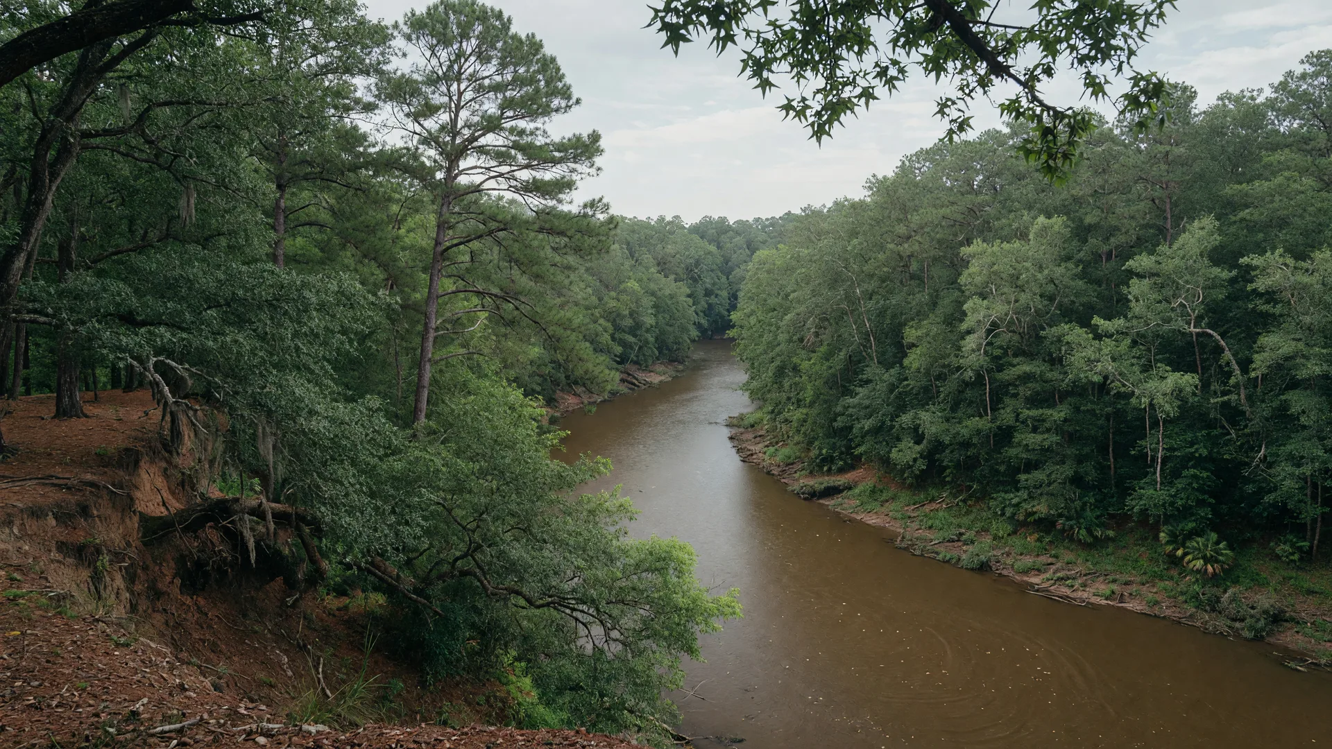
Every story about Lake Hartwell is, at its core, a story about what water does to land. Before the dam, the Savannah River ran free through this valley — a brown, muscular current that flooded its banks in spring, ran shallow in August, and connected the Georgia Piedmont to the Atlantic Ocean over 300 miles away. When the Corps of Engineers closed the gates at Hartwell Dam in 1959 and the water began to rise, the river did not disappear. It became something else. And the land that survived the transformation, like the 4.546 acres at 257 Methodist Park Lane, became something else too. This is the story of what the river gave, what the lake gives back, and what it means to live on the line between both worlds.
What the river gave
The Savannah River was not a gentle waterway. It carried runoff from the Appalachian foothills, silt from the eroded soils of upstream farms, and the seasonal pulse of spring rains that could turn it from a manageable stream into a half-mile-wide flood in a matter of days. The families who lived along its banks understood its rhythms the way a farmer understands weather: not as something to control, but as something to work with.
The river gave the valley its fertility. The periodic floods deposited nutrient-rich silt across the bottomlands, creating farmland that could produce corn, cotton, hay, and vegetables with a productivity that the upland soils could not match. The river gave the valley its transportation — before the railroads reached Hart County, the Savannah was the highway that connected this corner of Georgia to Augusta and the coast. And the river gave the valley its boundaries. The property lines that still define 257 Methodist Park Lane were drawn with the river as a reference point, because the river was the one feature of the landscape that would not move.
For the family that built the farmhouse in 1873, the river was the eastern boundary of their world. It provided water for their livestock, fish for their table, and a natural barrier that protected their land from encroachment. But the river also took. Spring floods could wash away a season's work. Droughts could leave the channel so shallow that a man could walk across it. The river was not a recreational amenity. It was a force of nature, and living alongside it required a certain toughness and a willingness to adapt.
When the water changed
The Flood Control Act of 1950 authorized the construction of Hartwell Dam as part of a system of three dams on the Savannah River — Hartwell, Richard B. Russell, and J. Strom Thurmond. The dam's purposes were flood control, hydropower generation, and navigation. Recreation was not the primary goal, though it became the most visible result.
Construction began in 1955. For eight years, the families of Hart County watched the river change. The dam rose across the river channel near the Georgia-South Carolina line. The water behind it spread slowly at first, then faster as the gates were closed and the reservoir began to fill. By the time the lake reached full pool in 1963, 56,000 acres of land were underwater. Nearly 2,000 families were displaced. Entire communities — Andersonville, New Hope, and others — vanished beneath the surface.
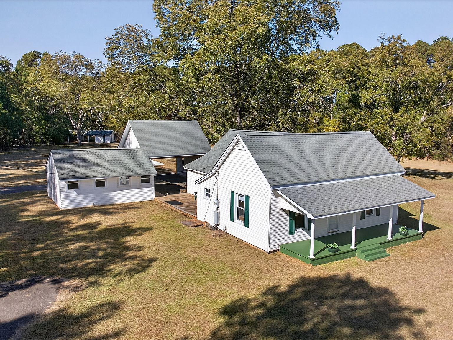
But a handful of properties on higher ground survived. The land at 257 Methodist Park Lane, sitting on a natural rise above the old river channel, was one of them. The water came to within a few hundred feet of the farmhouse and stopped. The river that had defined the eastern edge of the property for eighty years was suddenly a lake, and the family that had worked the land for three generations found themselves living not on a river farm but on a lakefront estate.
What the lake gives back
The lake gave the families who stayed something the river never could: stability. The water level at Hartwell is managed by the Corps of Engineers. It rises and falls within a predictable range. There are no spring floods that wipe out a season's work. There are no August droughts that leave the channel dry. The lake is a controlled environment, and that control has transformed the land along its shores from agricultural frontier into recreational asset.
For the property at 257 Methodist Park Lane, the lake turned a working farm into a weekend destination and then into a legacy estate. The pavilion that stands near the shoreline today was built not for farming but for gathering. The flat lawn that once grew corn and hay is now the backdrop for weddings, birthday parties, and quiet evenings watching the sunset over the water. The dock that reaches into the cove is not for loading cargo but for tying up a pontoon boat, launching a kayak, or sitting with a fishing rod at dawn.
The lake also gave the property a new kind of value. The same 4.546 acres that supported a family through subsistence farming now support a lifestyle that people travel hundreds of miles to experience. Lake Hartwell draws more than 9 million visitors annually. It hosts Bassmaster Classics, music festivals, and fireworks displays that draw crowds from across the Southeast. The property's position on the Georgia shoreline, minutes from Elrod Ferry Landing and Methodist Park, places it at the center of a recreational economy that did not exist 70 years ago.
But the lake gave back something less tangible, too. It gave the property a new identity. The farmhouse that was built in 1873 as a shelter for a farming family is now a 153-year-old historic home on one of the most desirable lakes in the Southeast. The land that was valued for its soil is now valued for its shoreline. The trees that were planted for shade and food are now the canopy under which generations of families have celebrated holidays, summer weekends, and the simple pleasure of being on the water.
What endures beneath the surface
The river is still there. It runs beneath the lake, following the same channel it has followed for millennia. The Corps of Engineers manages the lake's water levels, but the Savannah River is the foundation on which the reservoir rests. The old river channel is still visible on bathymetric maps — a darker line winding through the blue of the lake, connecting Hartwell Dam to the river upstream.
The families who lived in the valley before the lake are still part of this place, too. Their cemeteries were relocated before the water rose, but the memory of their presence is woven into the land. The pecan trees at 257 Methodist Park Lane were planted before the Civil War ended. The farmhouse was built when Ulysses S. Grant was president. The land has held the same boundaries since before the automobile, before electricity reached Hart County, before anyone imagined that the Savannah River could be stopped and held and turned into something else.
What endures is not the river or the lake. It is the land itself, and the willingness of the people who hold it to adapt to whatever the water does next.
Living on both sides of the transformation
257 Methodist Park Lane is one of the few properties on Lake Hartwell's Georgia shoreline that has experienced both sides of the transformation. It was a working river-bottom farm. It is a lakefront estate. It was a place where survival depended on the land's productivity. It is a place where quality of life depends on the land's beauty and privacy. It was a family homestead. It can still be a family homestead, if the next owner chooses that path.
The property does not ask you to choose one identity over the other. The pecan trees still produce. The lawn is still large enough to garden. The flat, open land that made this a good farm in 1873 is the same flat, open land that makes it a good estate in 2026. The lake added a dimension without erasing what was there before. That is the rarest quality a property can have: the ability to be transformed without losing its original character.
The river gave this land its beginning. The lake gave it its future. And the family that holds it has given it the one thing neither the river nor the lake could provide: the continuity of care that keeps a property alive through both its incarnations.