
Heritage
From the well to the lake: the one resource that has defined every generation at 257 Methodist Park Lane
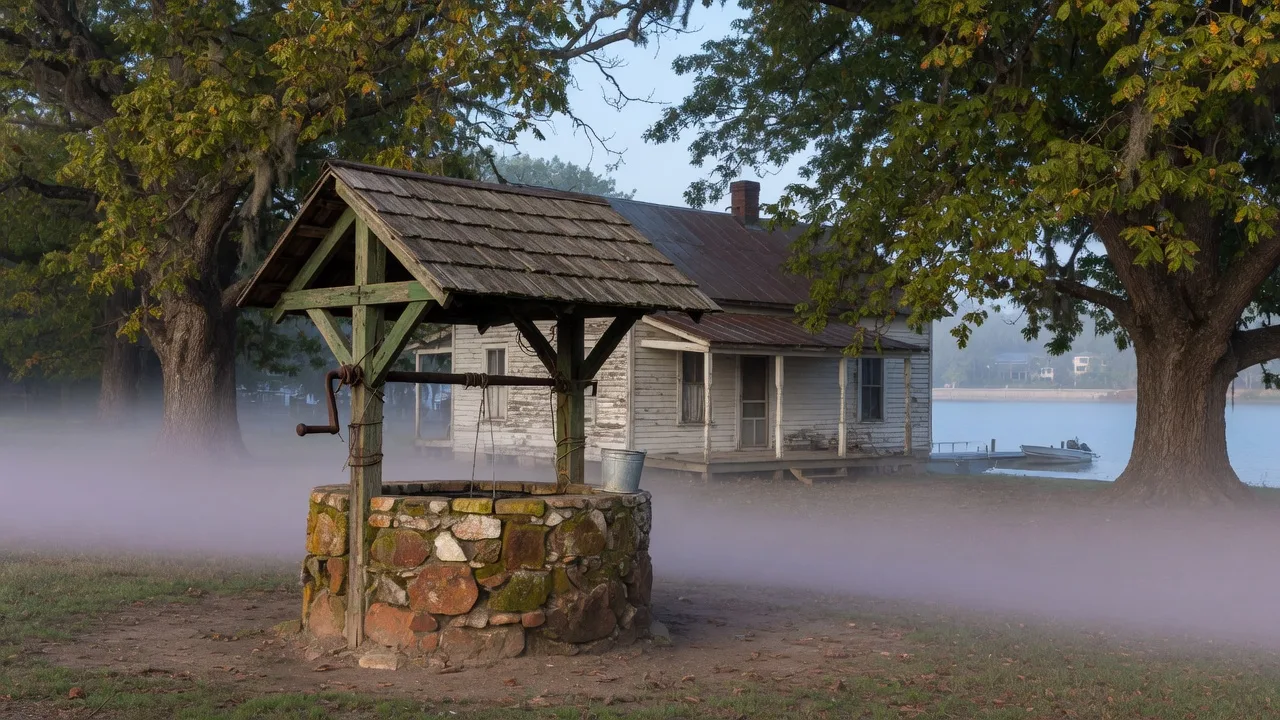
There is an old well on the property at 257 Methodist Park Lane. It sits near the house, capped and silent now, its stone collar weathered by a century and a half of Georgia summers and winters. The first generation dug it by hand in the 1870s, sinking a shaft through clay and rock until they struck the aquifer that runs beneath this ridge. That well was the heart of the homestead for over eighty years. Every bucket of water that the family drank, cooked with, bathed in, and used to wash clothes came from that hole in the ground. Today, the well is a relic. But the resource it drew from — water, on this land — is still the defining feature of the property. It has simply changed form.
The first generation and the well
For the families who lived on this land between 1873 and the arrival of municipal water in the mid-20th century, the well was the difference between survival and crisis. A well that went dry in summer, or that became contaminated by surface runoff after a hard rain, was not an inconvenience — it was an emergency. The family at Methodist Park Lane maintained their well with the attention that such a critical resource demanded: keeping the area around it clear of livestock, ensuring the stone collar was sound, and monitoring the water level through the seasonal cycles of drought and replenishment.
The well's location was no accident. The 1873 homesteaders had chosen this spot on the ridge because the water table was accessible here — close enough to the surface to reach by hand digging, but elevated enough to stay clear of the Savannah River's floodplain. That same elevation, we should note, is the reason the house stayed dry during the floods that periodically swept the valley, and it is the reason the property sat above the full-pool line when Lake Hartwell was filled a century later. The first generation's understanding of water, even at the most basic level of digging a well, shaped the entire future of this estate.
The well served the second generation, and the third, and the fourth. By the time the fifth generation took over the property in the 1940s, the well was still the primary water source. The routine was unchanged from the 1870s: lower the bucket, haul it up, carry it to the house. That kind of labor, repeated daily across six decades, built a relationship with water that no modern homeowner can fully replicate. When you have carried every drop you use, you understand the resource in a way that turning a faucet handle cannot teach.
The river as the second water
If the well was the family's internal water source — the supply for the household — the Savannah River was the external one. The river defined the southern boundary of the property and served purposes the well could not: irrigation for crops, water for livestock, fishing for food, and transportation for goods. The family's relationship with the river was different from their relationship with the well. The well was reliable and predictable. The river was wild and seasonal, rising with spring rains and falling during summer dry spells, sometimes flooding the lower fields and other times receding so far that the fishing changed.
The rhythm of the river taught the family something that the well could not: that water is not always under your control. You could dig a well and count on it. But the river did what it wanted, and the family had to adapt. They built their house above the flood line. They planted crops that could survive the occasional inundation. They learned to read the river's signals — the color, the speed, the debris it carried — as a language that told them what the coming weeks would bring.
The generation that watched the water change
The fifth or sixth generation on this land — the one that managed the property through the 1950s and 1960s — experienced a transformation in the family's relationship with water that no previous generation could have imagined. The river that had been part of their identity for nearly a century was about to become a lake.
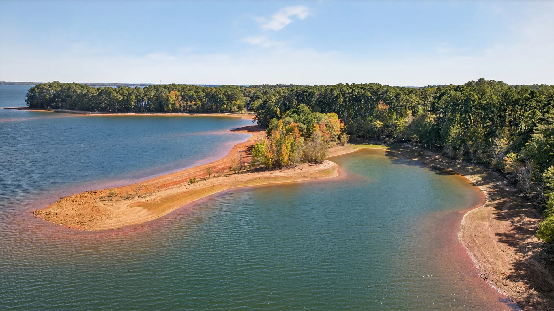
The Flood Control Act of 1950 had authorized the construction of Hartwell Dam. By 1955, the U.S. Army Corps of Engineers was clearing the valley, demolishing structures, and preparing the landscape to be submerged under a 56,000-acre reservoir. The family at Methodist Park Lane watched as the Savannah River valley they had known for generations was systematically prepared for its transformation. The river they had fished, farmed beside, and relied upon for transport would now be drowned beneath a lake that bore no resemblance to the original watercourse.
But the family made a choice that would define the next century of the property: they stayed. The elevation that had kept the house above the flood line also kept it above the full-pool line. The well that had served six generations would be replaced by modern plumbing, but the land that held the well would remain in the family. They adapted their relationship with water one more time. Instead of drawing from the well and respecting the river, they would now live on the edge of a 56,000-acre lake.
Water in the modern era
Today, the water story at 257 Methodist Park Lane is completely different from what it was in 1873. The well is capped. The river is submerged. The property draws its water from the county system, connected to the same municipal infrastructure that serves downtown Hartwell. The relationship with water has shifted from survival to enjoyment.
But the shift is not as complete as it might seem. The lake that replaced the river is managed by the same Corps of Engineers that dammed the Savannah. The shoreline is protected by Corps regulations that prevent development — no seawalls, no private docks that violate the natural shoreline buffer, no intensive commercial construction along the bank. That management policy is the reason Lake Hartwell's water quality remains high enough to support the 21 species of fish, the 250 species of birds, and the 9 million annual visitors who make the lake an economic engine for Hart County.
In the summer of 2026, Lake Hartwell is running several feet below full pool due to the drought conditions declared by the Georgia Environmental Protection Division. For the owner of a property on the Corps-managed shoreline, low water is a reminder that the lake is a managed resource, not a natural one. The pool level rises and falls based on rainfall, upstream releases, and the power generation schedule at the dam. The shoreline advances and retreats. The relationship with water remains one of adaptation, just as it was for the family with the hand-dug well.
What the continuity of water means
There is a through-line from the well to the lake that connects every generation who has lived on this land. The resource is the same — water, in its various forms, on this specific piece of Georgia ground. What has changed is the nature of the relationship: from labor to leisure, from survival to enjoyment, from the weight of a bucket to the view from a porch.
The old well still stands on the property. It will not be used again. But it matters that it is there. It is a physical reminder that the family who built this home in 1873 understood something fundamental about the land they had chosen: that water was the most important resource, and that building where the water was accessible and reliable was the most important decision they could make. That decision, made by people whose names we do not know, is the reason the next owner will be able to sit on the covered porch, coffee in hand, watching the mist rise off a 56,000-acre lake that did not exist when the well was dug.
That is the story that water tells on this property. It connects the generations. It explains why the house was built here and not somewhere else. And it reminds everyone who visits that the land has been in a relationship with water for a very long time — a relationship that the next owner will have the privilege of continuing.