
Heritage
Living on the land before the lake: a family's view of the transformation
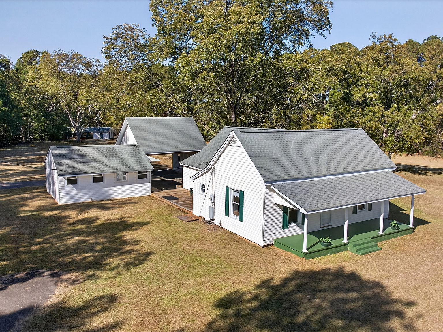
There's a photograph in the Hartwell Historical Society archives — taken sometime in the late 1940s — of a family standing on the porch of a white clapboard farmhouse. The lawn slopes gently toward a river. The pecan trees are younger then, their canopies not yet meeting overhead. There is no lake in the photograph. There is a river, a valley, and a family who has lived on this land long enough to know every contour of it. That family is gone now. But the house — and the land it sits on — is still here.
The valley that was
Before the U.S. Army Corps of Engineers began construction in 1955, the land now covered by Lake Hartwell was a living landscape. The Savannah River and its tributaries — the Seneca, the Tugaloo, the Chattooga — threaded through a valley of rich bottomland, red clay hills, and hardwood forest. Families had farmed this ground since the early 1800s, and some Native American communities had lived here for over a thousand years before that.
The daily life of these families was defined by the river and the seasons. Spring meant planting corn, cotton, and vegetables in the bottomland soil — some of the most productive agricultural ground in northeast Georgia. Summer meant managing the crops, fishing the river for catfish and bream, and gathering the community for church socials and barn raisings. Fall was harvest. Winter was repair — mending fences, splitting firewood, sharpening tools for the year ahead.
The homes were practical, built from local timber and oriented to catch the prevailing breezes. Porches weren't decorative — they were the primary living space from spring through fall, the place where families ate, socialized, and watched the river for signs of flood. The pecan trees that shade the lawn at 257 Methodist Park Lane were planted during this era — not for aesthetics, but for food. A mature pecan tree can produce 50 to 100 pounds of nuts per year. In a rural Georgia community, that was a meaningful contribution to a family's winter stores.
The announcement that changed everything
The Flood Control Act of 1950 authorized the Hartwell Dam project as part of a broader federal initiative to control flooding along the Savannah River, generate hydroelectric power, and improve navigation downstream. For the families living in the valley, the announcement arrived not as a single moment but as a slow-moving reality that unfolded over years.
The Corps of Engineers began acquiring land in the early 1950s. Families received letters. Appraisals were conducted. Negotiations followed — sometimes amicable, sometimes contentious, often inadequate. The federal government's offer for prime bottomland rarely matched what the families knew the land was worth, not in dollars but in generations of work. Some families accepted and relocated. Others fought the process. Most eventually yielded to the inevitability of a federal project that had the full weight of Congress behind it.
Between 1955 and 1963, the dam went up and the water rose. An estimated 2,000 families were displaced. Entire communities — including the historic town of Andersonville, South Carolina, which had been a trading hub at the confluence of the Seneca and Tugaloo Rivers — were submerged. Homes, barns, churches, bridges, and family cemeteries disappeared beneath the surface. Archaeological salvage teams from the University of Georgia recovered artifacts from prehistoric and historic sites, but much of the cultural landscape was lost.
Why this property survived
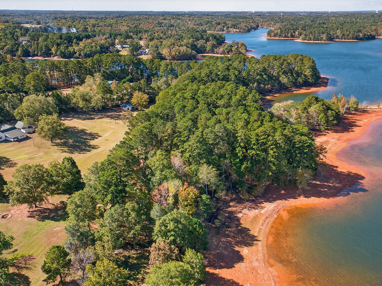
Not every property in the valley was lost. The Corps acquired the land needed for the reservoir — the low-lying bottomland, the riverbanks, the flood-prone areas that would be permanently submerged. But parcels on higher ground — properties with enough elevation to sit above the full-pool line — survived. 257 Methodist Park Lane is one of them.
The home was built in 1873 on a rise of flat, well-drained land — high enough to avoid flooding but close enough to the river valley to benefit from the water, the fertile soil, and the gentle microclimate that river valleys create. When the water rose, the property found itself on the edge of a lake rather than beneath it. The river became a shoreline. The valley became a cove. And the family — which had been on this land for generations — stayed.
The decision to stay was not trivial. The lake transformed the landscape in ways that were both beneficial and disruptive. The fishing improved dramatically — a 56,000-acre reservoir produces far more fish than a river. The view changed from a wooded riverbank to an expanse of open water that caught the light differently in every season. But the community that had existed along the river scattered. Neighbors who had been a five-minute walk apart became a boat ride away. The rhythms of agricultural life — planting, harvest, livestock — gave way to the rhythms of lake life — boating, fishing, swimming.
The family adapted. The porch, originally built to watch the river, now watched the lake. A pavilion was added when outdoor entertaining became the way weekends were spent. The pecan trees, which had been planted for food, became the mature grove that now provides hours of afternoon shade across four and a half acres of flat lawn. The property evolved from a working homestead into a lakefront estate — but the bones, the foundation, and the relationship to the land remained the same.
The view from the porch, then and now
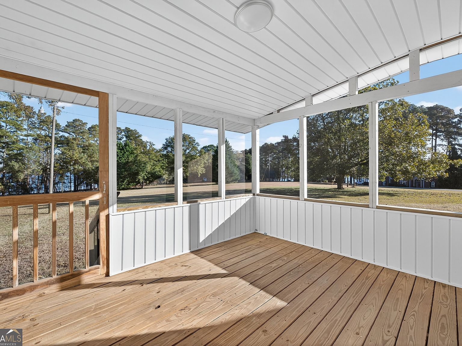
Stand on the covered porch at 257 Methodist Park Lane today and you're standing in the same spot where the family in that archival photograph stood seventy-five years ago. The columns are the same. The orientation is the same. The view — from the porch across the lawn, through the pecan trees, toward the water — is the same shape, even though the water itself is different.
In the photograph, you see a river. In person, you see a lake. But the experience of looking out from this porch — the cross-breeze, the shade, the flat lawn rolling toward the tree line — is unchanged. The land remembers what it was. The water tells you what it became. And the house, built in 1873 and expanded across generations, holds the space between those two realities.
What it means to inherit a transformed landscape
The families who stayed on properties like 257 Methodist Park Lane during the lake's creation experienced something that's difficult to articulate to outsiders: they watched their world change fundamentally and chose to remain part of it. The river became a lake. The neighbors left. The roads were rerouted. The church that served the community was either relocated or submerged. And still, they stayed.
That decision — to hold the land through a period of radical transformation — is part of the property's inheritance. When we talk about the history of 257 Methodist Park Lane, we're not talking about a building. We're talking about a family's willingness to adapt to a landscape that changed around them while maintaining their relationship to the ground beneath their feet.
For today's prospective buyer, that legacy is both a gift and a context. The property isn't just a waterfront estate on a lake. It's a piece of land that has been continuously occupied since before the Civil War, that survived the creation of a 56,000-acre reservoir, and that has been maintained across generations by people who understood the difference between a transaction and a trust.
The pecan trees are older now. The lawn is wider. The water stretches to the horizon instead of winding through a valley. But the porch faces the same direction. The breeze comes from the same place. And the land — flat, private, 4.546 acres of Georgia shoreline on one of the last remaining large parcels on Lake Hartwell — remains what it has always been: a place worth holding onto.
The question for the next owner is simple: are you ready to continue what the previous generations started? Not to buy a property, but to join a story that began in 1873, survived a federal dam project, and is still being written.