
Heritage
The thousand-year shore: Cherokee towns, Mississippian mounds, and the land at 257 Methodist Park Lane
When the Cherokee called this region Ah-Yeh-Li A-Lo-Hee — "Center of the World" — they weren't speaking metaphorically. The confluence of the Seneca, Tugaloo, and Savannah Rivers created one of the most strategically and agriculturally significant locations in the southeastern interior. The land at 257 Methodist Park Lane sits in the middle of that convergence, above the river valley, on ground that has sustained human life for over a thousand years.
The Tugaloo Valley: a thousand years of habitation
Before the lake, before the dam, before the farmhouse, the Tugaloo Valley was one of the most densely settled regions in the southern Appalachian piedmont. Archaeological evidence shows continuous human occupation spanning from the Late Archaic period through the Mississippian era — over a thousand years of villages, ceremonial sites, and agricultural communities built along the river banks.
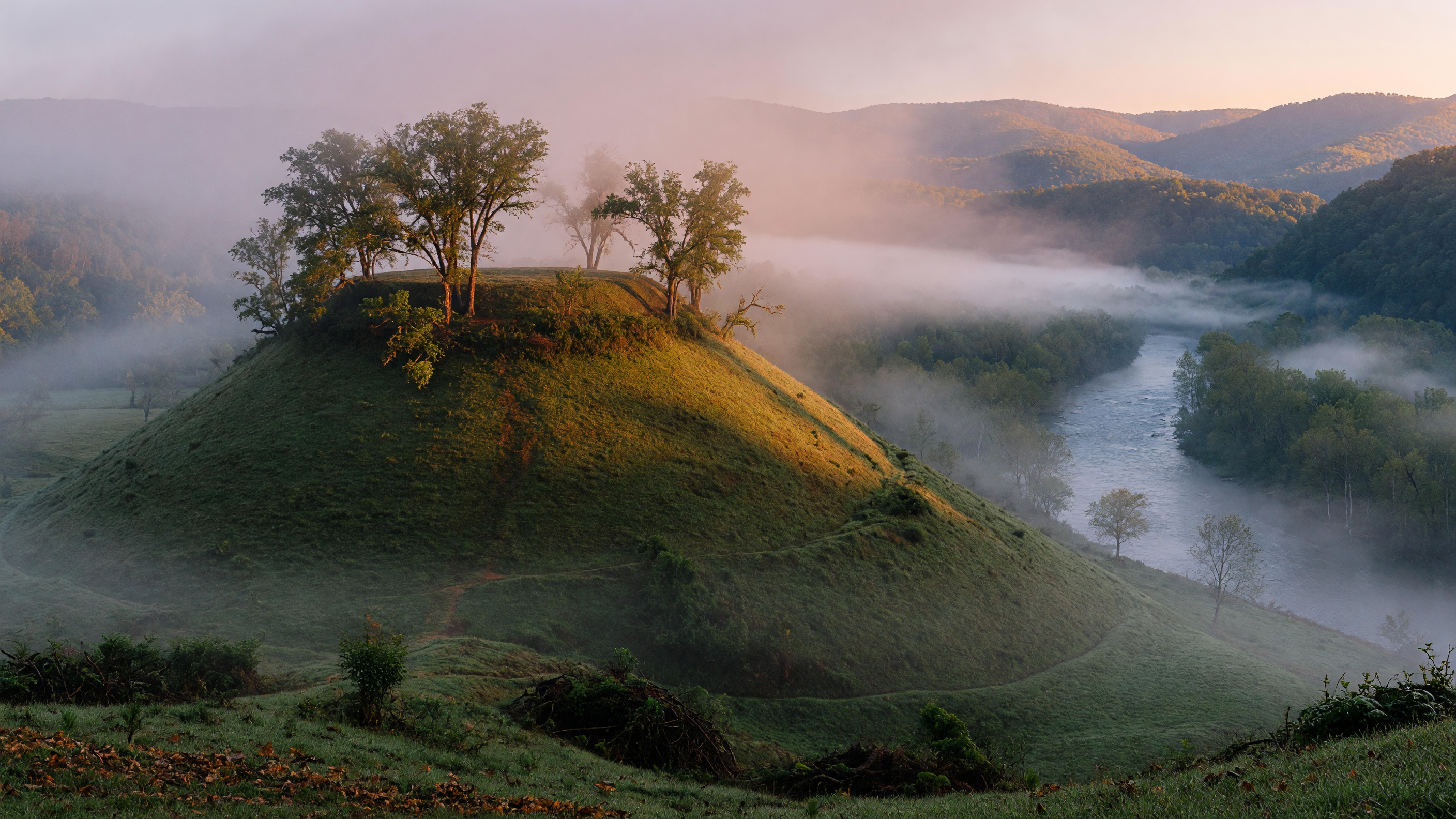
The Mississippian culture, which flourished across the southeastern United States from roughly 900 to 1600 CE, left its mark on this landscape in the form of platform mounds — earthen structures that served as foundations for ceremonial buildings, chief's residences, and community gathering spaces. The Tugaloo site, located at the mouth of Toccoa Creek where it met the Tugaloo River, featured a prominent mound topped by a seven-sided Cherokee council house. The mound itself was built centuries before the Cherokee arrived, a testament to the layered history of the site.
When the Cherokee established their "Lower Towns" along the rivers of the Georgia and South Carolina piedmont in the 17th and 18th centuries, they built upon and adapted these ancient sites. Tugaloo became one of the most important Cherokee towns — a center of diplomacy, trade, and, at times, conflict. The town's location at the confluence of major rivers gave it strategic importance that few other settlements in the region could match.
Estatoe and the network of towns
Tugaloo was not alone. The river system that flows past 257 Methodist Park Lane connected a network of Cherokee Lower Towns — Estatoe, Tugaloo, Toccapulco, and others — each positioned at strategic points along the Seneca, Tugaloo, and Chattooga Rivers. These towns were linked by river travel, trading paths, and kinship networks that stretched from the Blue Ridge mountains to the Georgia coast.
Estatoe, documented near the present-day Lake Hartwell shoreline, was a substantial settlement that occupied the same kind of riverine position as Tugaloo — near a confluence, on elevated ground above the floodplain, with access to both water transportation and fertile agricultural land. The townspeople grew corn, beans, and squash in the rich bottomland, hunted in the surrounding forests, and traded with both neighboring Cherokee communities and, increasingly, European traders who pushed inland from the Carolina coast.
What's remarkable about this landscape isn't just the individual towns — it's the density of habitation. The Tugaloo Valley was, for over a millennium, one of the most actively settled landscapes in the Appalachian piedmont. The same qualities that made it attractive to indigenous communities — the water, the fertile soil, the confluence of navigable rivers — are the same qualities that drew European settlers in the 19th century, and the same qualities that make the Lake Hartwell shoreline desirable today.
The European settlers and the 1873 farmhouse
Following the Cherokee Removal Act of 1838 — the Trail of Tears — the land in the Tugaloo Valley passed through various hands as European-American settlers moved into the territory vacated by the Cherokee. The rich bottomland that had sustained indigenous agriculture proved equally productive for cotton farming, and the river valleys filled with homesteads, mills, and trading posts.
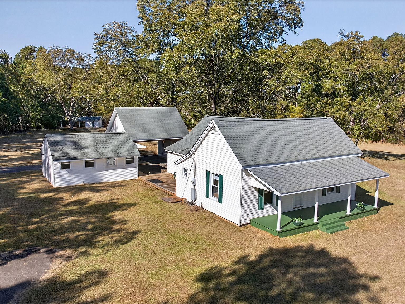
The farmhouse at 257 Methodist Park Lane was built in 1873, during Reconstruction — a period when families in the Georgia foothills were rebuilding after the Civil War with whatever materials were local and available. The choice of this particular site reflected the same logic that had drawn Mississippian mound builders to the valley a thousand years earlier: elevated ground above the floodplain, proximity to water, fertile soil, and the kind of natural setting that suggested permanence.
The family that built the home chose well. The property sits on 4.546 acres of flat, private land — high enough to avoid the periodic flooding that plagued the river bottomland, close enough to the water to benefit from its resources, and set on ground that had been continuously occupied for centuries. They planted pecan trees. They built a working homestead. And they established the kind of deep connection to the land that would sustain their family through every transformation the valley would undergo.
The salvage archaeology before the water came
When the U.S. Army Corps of Engineers announced the Hartwell Dam project in the 1950s, the archaeological community understood what was at stake. The Tugaloo Valley contained some of the most significant indigenous archaeological sites in the Southeast — and the reservoir would submerge them permanently.
In 1957 and 1959, teams from the University of Georgia and the Smithsonian Institution conducted salvage excavations at the Tugaloo and Estatoe sites — racing against the construction schedule to document, map, and recover artifacts before the water rose. The excavations uncovered pottery, stone tools, architectural remnants, and evidence of the Mississippian platform mound at Tugaloo. The Tugalo Baptist Church, founded before 1789 and sometimes called the "Mother Church" of the region, stood near the site until the land was claimed by the reservoir.
The salvage effort was significant but inevitably incomplete. A thousand years of human habitation cannot be fully documented in two field seasons. What was recovered went to university collections and museums. What was left behind — the foundations, the burial sites, the unexcavated portions of the mounds — went beneath the water. Today, when the lake level drops during drought years, fragments of this submerged landscape occasionally become visible: stone foundations, chimney stacks, the remnants of a world that existed long before anyone imagined a dam.
Living on ancient ground
There's a particular quality to a property that sits on land with deep human history. The ground at 257 Methodist Park Lane isn't just soil — it's a record. For over a thousand years, people chose this location for the same reasons: the elevated position above the river valley, the access to water, the fertile ground, the protection offered by the surrounding hills. The Mississippian mound builders recognized it. The Cherokee built upon it. The 1873 farmhouse family settled it. And today, the property represents the latest chapter in a story that spans millennia.
When you walk the grounds, you're walking on ground that has been continuously valued and maintained by human hands for longer than any European-descended family has been in the Americas. The pecan trees, planted in the 19th century, are the most visible markers of that continuity — but beneath the surface, the soil itself carries the record of a thousand years of planting, building, and habitation.
The property's position above the lake — close enough to claim the water lifestyle, high enough to have avoided the reservoir that submerged the valley below — is the reason it exists today. The same elevation that made it safe from the dam's flood zone is the same elevation that made it attractive to Mississippian builders a thousand years ago. The land has always known what it was worth.
What the history asks of the next owner
Ownership of a property with this depth of history carries a particular responsibility. The families who lived on this land — Mississippian, Cherokee, and American — each understood that the land was not something to be used and discarded. It was something to be maintained, improved, and passed along. The pecan grove is the physical expression of that understanding: trees planted not for the planter's lifetime but for the next generation's.
The next owner of 257 Methodist Park Lane inherits that tradition. The 1873 farmhouse, the pecan grove, the 4.5 acres of flat private land, the natural shoreline, the lakeside pavilion — these are the features of a property that has been stewarded for 153 years and will, with the right owner, be stewarded for 153 more.
In our experience at The Petrenko Group, the buyers who are drawn to properties like this aren't looking for a transaction. They're looking for a continuation. They understand that the land has a story, that the story includes them, and that their role is to write the next chapter while preserving the ones that came before.
That's not a burden. It's a privilege — and for the right family, it's the whole point.