
History
The towns beneath Lake Hartwell
Stand on the dock at 257 Methodist Park Lane on a calm morning and look straight down into the water. The lake is clear here — you can see the bottom at fifteen feet. What you can't see is what lies further out: the foundations of communities that were here long before the water was.
Andersonville: the town the lake swallowed
One of the most well-documented communities lost to Lake Hartwell is Andersonville, South Carolina — not to be confused with the more famous Andersonville Prison in central Georgia. The original Andersonville was founded in 1801 at the confluence of the Seneca and Tugaloo Rivers, named for Revolutionary War veteran Robert Anderson. For over 150 years, it served as a regional trade center, river port, and farming community.
By the mid-20th century, Andersonville had already been in decline. Frequent flooding from the rivers had taken a toll, rail transportation had bypassed the town, and economic shifts had drawn residents elsewhere. When the U.S. Army Corps of Engineers began constructing the Hartwell Dam in 1955, Andersonville was effectively a ghost town — but it was still there. The dam's completion in 1963 and the subsequent filling of the reservoir submerged the town site entirely.
Today, all that remains is Andersonville Island — a narrow, two-mile-long strip of land that was once the town's higher ground. The graves from the town's cemetery were relocated to the Andersonville Baptist Church on the eastern shore before the water rose. The rest — the buildings, the roads, the river-port infrastructure — sits beneath the lake.
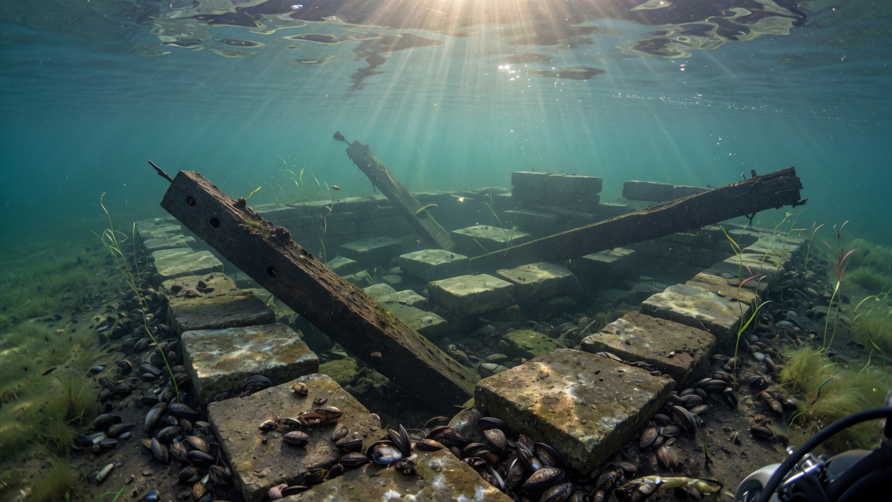
Tugaloo: a thousand years beneath the waves
The losses extended far beyond Andersonville. At the mouth of Toccoa Creek, where the Tugaloo River met the Seneca, lay Tugaloo — one of the most historically significant Cherokee "Lower Towns" in the Southeast. Archaeological evidence shows the site had been occupied for over a thousand years, through the Mississippian and Yuchi cultures, before becoming a prominent Cherokee settlement.
Tugaloo was a center of colonial diplomacy and conflict. In 1716, the town was the site of a devastating massacre during the Yamasee War, when Cherokee residents killed a Muscogee Creek delegation. After the Cherokee Removal Act of the 1830s, the land passed through various owners, but the archaeological record remained — a seven-sided Cherokee council house sat atop the Tugaloo Mound, a testament to centuries of indigenous habitation.
Before the lake was created, teams from the University of Georgia and the Smithsonian Institution conducted "salvage" archaeology at the site, racing to document and recover artifacts before the water rose. The Tugalo Baptist Church, founded before 1789 and sometimes called the "Mother Church" of the region, stood in this vicinity until the land was claimed by the reservoir.
All of it — the mound, the church site, the council house location — now lies beneath the water. When the lake is low, occasionally structural remnants become visible, brief windows into a world that existed for a millennium before anyone thought of a dam.
The families who were displaced
The human cost of Lake Hartwell's creation is harder to quantify than the submerged acreage. The Corps of Engineers acquired tens of thousands of acres through purchase and eminent domain. Families who had farmed the same bottomland for generations were compensated and relocated — some to higher ground in the same county, others further afield.
The displacement was especially painful because the land being taken was among the most productive in the valley. River bottomland — the flat, rich soil closest to the water — had sustained these families for generations. What they received in exchange was often higher, rockier ground with less agricultural value. The economic equation worked for the nation, which gained flood control, hydroelectric power, and a massive recreational resource. For the individual families, the equation was different.
Some farmers refused to leave until the water literally reached their doorsteps. Others packed up quietly and moved on. The Hartwell Sun newspaper documented stories of families watching the water rise year by year, watching familiar landmarks disappear — a barn here, a road there, a church steeple poking above the surface for one final season before it, too, was submerged.
Why some properties survived
Not every property on the lake was lost. The Corps needed land for the reservoir pool — roughly the area that would be covered when the lake was at full pool elevation (660 feet above mean sea level) — plus a buffer zone. Properties on higher ground, parcels with enough elevation to sit above the full-pool line, survived. Others were acquired but never flooded, held by the Corps as buffer land along the shoreline.
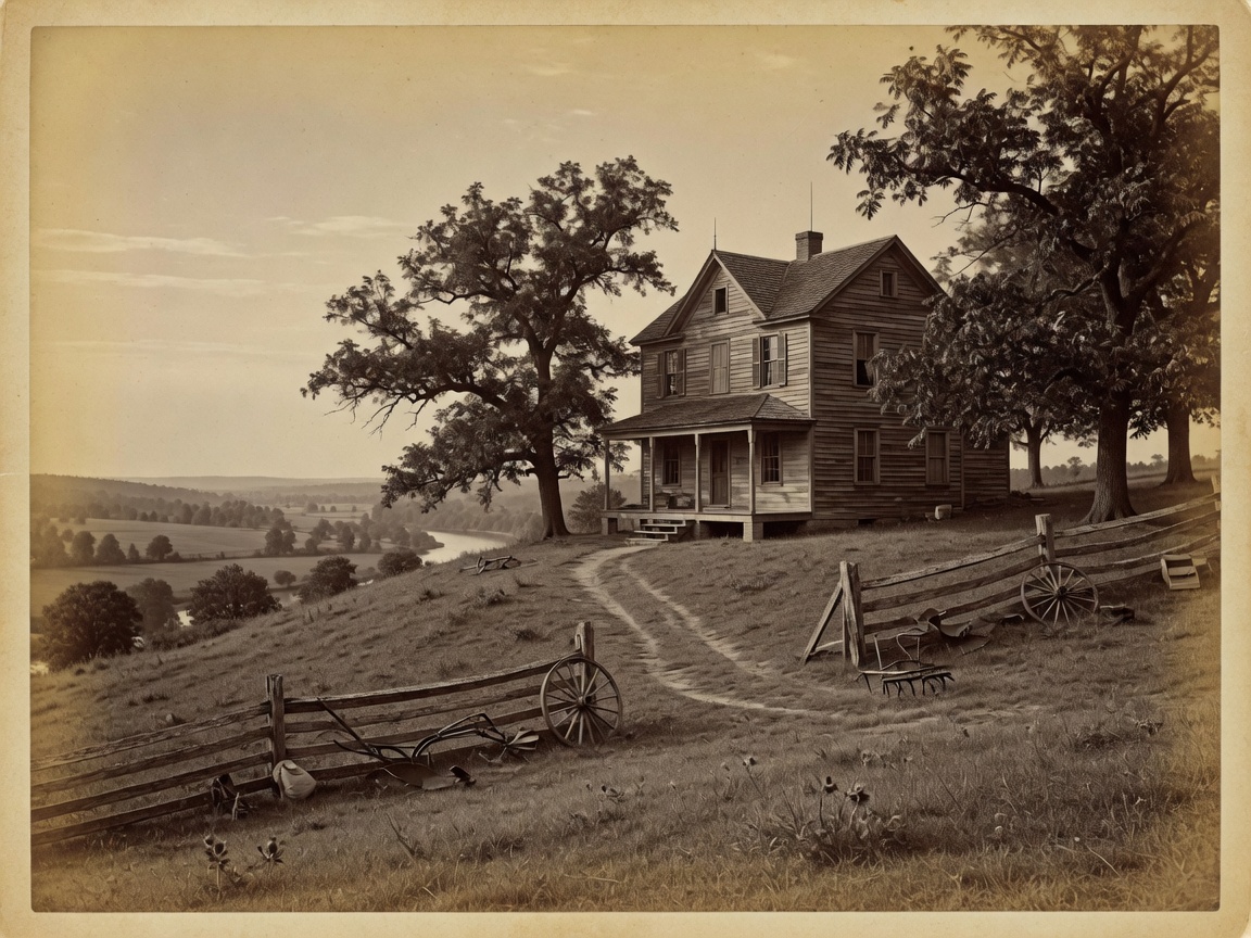
257 Methodist Park Lane is one of the properties that survived. Set on 4.546 acres of flat, private land above the flood zone, it occupies a position that was close enough to the water to benefit from the lake lifestyle but high enough to have avoided condemnation. The family that built the home in 1873 chose this spot for reasons that had nothing to do with a lake that wouldn't exist for another century — the flat ground, the mature pecan trees, the gentle slope toward the river valley, the access to water and fertile soil.
Those same qualities — the elevation, the flat land, the setting — are what allowed the property to survive when the water came. The family held the property through the displacement, through the construction, through the transformation of their river valley into a reservoir. This is one of the last remaining large-acreage parcels on Lake Hartwell's Georgia Corps of Engineers shoreline — not by accident, but by the foresight of generations who understood that good land endures.
What the water is still hiding
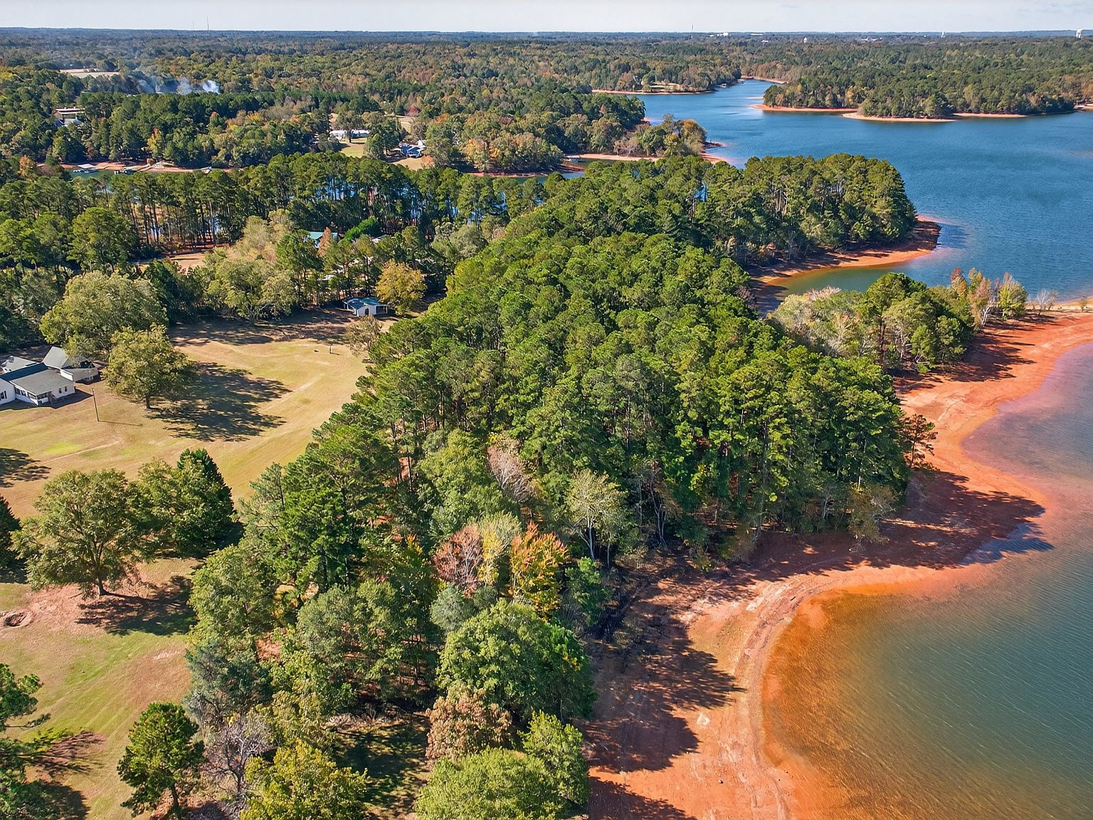
Lake Hartwell is 56,000 acres at full pool. When water levels drop — as they periodically do during drought years — more of the past becomes visible. Old fence lines appear. Foundation stones surface. Road beds that haven't been driven on since the 1950s emerge from the mud. For longtime residents, these moments are both fascinating and sobering: reminders that the lake is young, and what it covers is old.
In recent years, lower-than-normal water levels have periodically revealed more of the submerged landscape than usual. Boaters have reported seeing old stone walls, chimney stacks, and even remnants of paved roads in shallow areas near the old town sites. Each revelation is a reminder that the lake, for all its beauty and recreational value, sits on top of a much older story.
The property at 257 Methodist Park Lane sits above all of this — literally and figuratively. The 1873 home has been continuously occupied and maintained for 153 years. The pecan trees have provided shade and food for six or seven generations. The covered porch faces the same direction it always has, toward the valley that became a lake.
A property that chose to endure
When we show this property to potential buyers, one of the first things we mention is what lies beneath the water. Not as a curiosity, but as context. 257 Methodist Park Lane didn't survive by luck. It survived because someone built it on high ground, maintained it across generations, and chose to keep it when the world around it was being redrawn by federal infrastructure.
That story — of survival, of continuity, of land that endures through radical change — is what makes this property different from every other listing on Lake Hartwell. The ghost towns beneath the water are a reminder of what was lost. This property is a reminder of what can be kept.