
Heritage
When the water came: Hartwell, Georgia during the making of the lake, 1955–1963
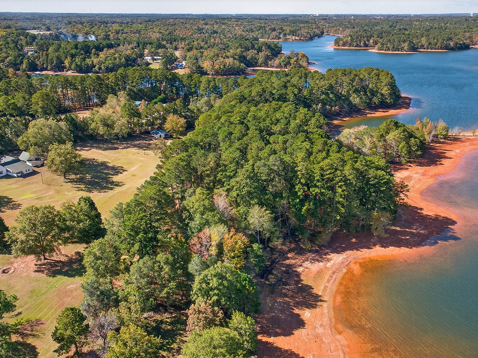
The families who lived on the hills above the Savannah River valley didn't learn about the dam from a newspaper. They learned from a surveyor who showed up on their land with a transit and a clipboard, measuring elevations and marking trees with orange paint. The full-pool line — 660 feet above sea level — was going to change everything. And for the families who owned the land at 257 Methodist Park Lane, the question was simple: would the water reach them?
The authorization
The Flood Control Act of 1950 authorized the construction of a dam on the Savannah River at a site between Hart County, Georgia, and Anderson County, South Carolina. The project had been studied since the 1930s, when the Tennessee Valley Authority and the Corps of Engineers began evaluating the river system for flood control, hydropower, and navigation. The Appalachian foothills of northeast Georgia were prone to flooding — the Savannah and its tributaries, the Seneca and Tugaloo, regularly overwhelmed the bottomlands during spring rains, damaging farms, drowning livestock, and making the river valley a risky place to invest.
The dam promised to solve that problem. It would also create one of the largest man-made reservoirs in the Southeast: 56,000 acres of water with nearly 1,000 miles of shoreline, straddling the Georgia-South Carolina border. The project would flood the river valley, displace the families who lived there, and transform the economic and social identity of Hartwell, Georgia — a town founded in 1854, named after Revolutionary War heroine Nancy Hart, and built on agriculture for its first century.
Construction began in 1955. The dam — a massive earthen structure 1,640 feet long and 137 feet high — took five years to complete. The reservoir took another three years to fill. By 1963, the water had risen to its full-pool elevation, and the valley that had been home to farming families for generations was under 56,000 acres of lake.
Eight years of watching
For the families on the hills above the valley — the ones whose land was above the full-pool line, the ones who would survive the flooding — the eight years of construction were a period of sustained uncertainty. The Corps of Engineers needed their land for easements, access roads, and staging areas. Properties were appraised. Negotiations happened. Some families sold willingly; others held on through eminent domain proceedings that left lasting bitterness in the community.
The homes in the valley — farmhouses, barns, churches, stores — were demolished or moved. Some structures were relocated to higher ground, dragged on skids to new lots in Hartwell or Anderson. Others were simply torn down, their lumber salvaged and reused. Family cemeteries were exhumed and relocated — a process that was both legally required and emotionally devastating for families who had buried their dead in the same ground for generations.
On the hills, life continued with an edge of impermanence. The water rose slowly — a few feet each year as the dam's spillways released controlled flows. Each spring, the shoreline crept higher. Trees that had stood on dry ground for decades began to die as their roots sat in standing water. Roads that had connected farms to town were rerouted or abandoned as the rising water cut them off. The sound of heavy equipment — trucks, bulldozers, cranes — was a constant companion through the late 1950s, a reminder that the landscape was being permanently altered.
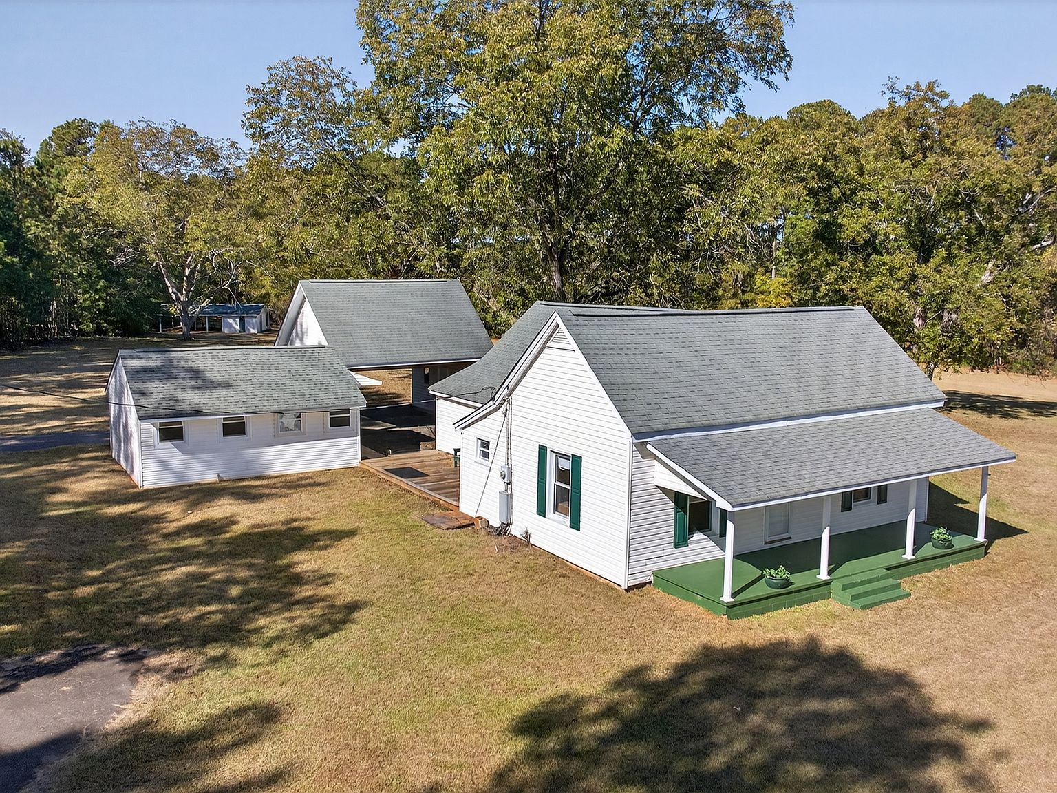
For the family at 257 Methodist Park Lane, the property's elevation was its salvation. The 4.546 acres sat high enough on the slope to remain above the full-pool line — close enough to the water to feel the lake's presence, but far enough above it to avoid the wrecking ball. The home, built in 1873, survived. The pecan trees survived. The flat lawn, the covered porch, the sense of place that had been accumulating for over 80 years — all of it survived. Not because of luck, but because someone had built this home on ground that chose to endure.
What the water took
The creation of Lake Hartwell didn't just flood land — it submerged a way of life. The river valley communities along the Savannah, Seneca, and Tugaloo Rivers had been farming, fishing, and trading for generations. The bottomland soil was among the most productive in the region, and the families who worked it understood the rhythms of the river — when to plant, when to harvest, when to expect the spring floods and when to build on higher ground.
Entire communities disappeared. Towns that had existed since the early 1800s — some with churches, schools, and commercial districts — were erased from the landscape. The water covered homes, barns, bridges, roads, and cemeteries. The river channels themselves — the confluences where the Seneca met the Tugaloo, where the Tugaloo met the Savannah — were reshaped into the coves and inlets of a reservoir that bore no resemblance to the rivers it replaced.
For Hartwell, Georgia, the transformation was existential. The county seat had been built on agriculture — cotton, then pecans, then the diversified farming that sustained small Southern towns through the 20th century. The lake promised a new economy: tourism, recreation, waterfront development. But it also meant that the town's identity shifted from producer to host, from a place where things were grown to a place where people came to play.
What the water gave
The economic case for Lake Hartwell was real. The reservoir became the centerpiece of a recreation economy that now draws approximately 9 million visitors annually — a staggering number for a rural Georgia county. Marinas, campgrounds, boat rentals, fishing guides, restaurants, and lodging operations employ hundreds of people in a region where the alternatives were limited to agriculture and the modest industries of a small county seat.
The community that grew up around the lake had its own character. Unlike the manufactured resort communities that would later appear on other southeastern lakes, Lake Hartwell's development was organic — families who already lived in the area discovered the water and built their social lives around it. The Lake Hartwell Boating Club became the social nucleus. Downtown Hartwell, which could have withered as tourism pulled spending to the waterfront, instead evolved into a complementary destination — a Main Street with real character, restaurants with real kitchens, and a community identity that blended agricultural heritage with lake culture.
The lake also created something that can't be measured in economic statistics: a shared experience. Families who bought waterfront lots in the 1960s and 1970s — the first wave of lake development — built the social infrastructure that still defines the community. They organized the boating club. They planned the Fourth of July fireworks over the water. They established the fishing tournaments, the dock gatherings, the informal traditions that make Lake Hartwell feel like a community rather than a collection of vacation homes. That foundation, laid in the decades immediately after the dam, is the reason the lake's social calendar is as rich as it is today.
The property that stayed
257 Methodist Park Lane is one of the last remaining large-acreage parcels on Lake Hartwell's Georgia Corps of Engineers shoreline. This isn't an accident. The Corps manages the shoreline around the reservoir, keeping the banks natural and undeveloped — a policy that preserves water quality and prevents the kind of intensive waterfront development that has degraded other southeastern lakes. Properties that sit above the full-pool line, on land that the Corps didn't acquire for the reservoir, are inherently rare. Properties of this size — 4.546 acres of flat, usable waterfront — are rarer still.
The family that built this home in 1873 chose the site for reasons that had nothing to do with a lake that wouldn't exist for another 90 years: the flat ground, the fertile soil, the proximity to the river valley, the mature pecan trees that provided food and shade. The family that held the property through the dam's construction chose to keep it because the same qualities that made it a good homestead made it a good estate — elevated, private, expansive, and close enough to the water to claim the lifestyle without being vulnerable to the water's power.
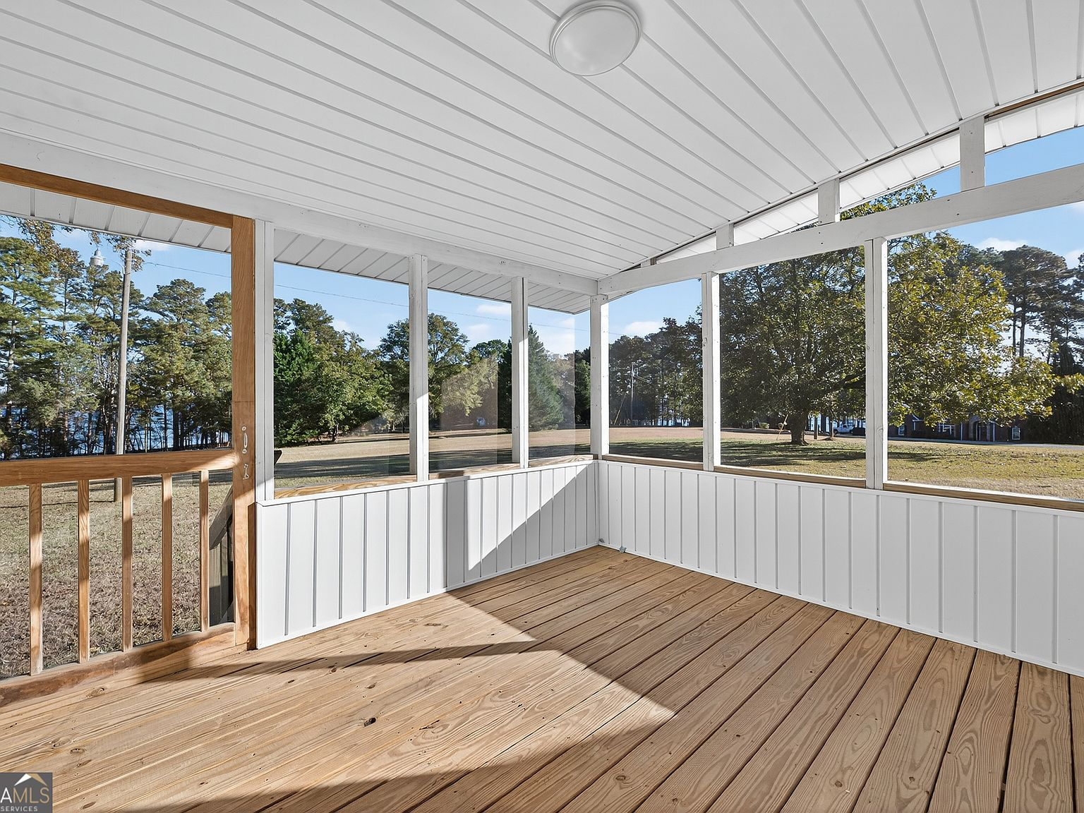
That choice — to hold, to maintain, to keep the property intact through decades of transformation — is the reason this estate exists today. The house has been expanded, updated, and cared for across six or seven generations. The lakeside pavilion was added when the lake arrived, designed to enjoy the water that had replaced the river. The covered porch, the screened back porch, the flat lawn, the pecan grove — all of it has been maintained not as a museum exhibit but as a living home that adapts to the conditions it faces.
What the story means
We tell this story not because it's quaint, but because it's relevant. The creation of Lake Hartwell was one of the largest infrastructure projects in the history of the American Southeast. It displaced thousands of families, submerged entire communities, and permanently altered the geography of northeast Georgia. But it also created something that didn't exist before: a 56,000-acre lake that has become the social and economic center of a region.
For a buyer at 257 Methodist Park Lane, this history isn't background noise. It's the context that makes the property meaningful. You're not buying a lakefront lot. You're buying a piece of land that was here before the lake, that watched the water rise, that survived the transformation, and that now sits on one of the last remaining large-acreage waterfront parcels on Lake Hartwell's Georgia shoreline. The pecan trees were planted before the dam was authorized. The home was built before the lake existed. The porch was designed to catch breezes from a river valley that is now a reservoir.
That layering of history — pre-dam homestead, survivor of the transformation, lakefront estate — is what makes this property irreplaceable. No builder can replicate it. No developer can create it. It exists because someone chose this ground in 1873, because someone else chose to keep it in 1955, and because the property has been maintained with care and intention ever since. The question for the next owner is whether you're ready to become part of that story — and whether you're willing to do what the families before you have done: hold, maintain, and pass along something that matters.